
NASA Satellite Imagery Reveals Dark Impact of Hurricane Isaias on US Gulf Coast
NASA's high-resolution satellite imagery captured a drastic reduction in nighttime light on the Florida Panhandle coast due to Hurricane Isaias. This phenomenon shows the impact of widespread power outages and the speed of the infrastructure recovery process in affected areas.
AI creates a new explanation from RingkasNow facts and source metadata—it does not copy or fully translate the source article.
News explanation
What happened
Key facts
Why it matters
Context
Who is involved / affected
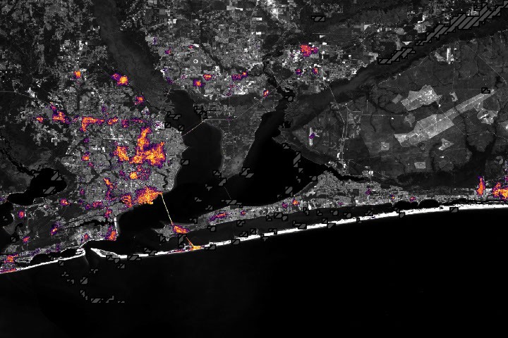
Image credit
Hurricane Isaias developed into the first hurricane of the Atlantic hurricane season as it moved toward the United States Gulf Coast. This storm triggered heavy rains and flash flooding in various southeastern regions, including Alabama and the Florida Panhandle.
The storm made landfall near Destin as a category two hurricane with maximum winds reaching one hundred and seventy kilometers per hour. The National Weather Service noted strong gusts of wind knocked down trees and knocked out residents' power lines.
Black Marble HD satellite imagery products show the fading evening light in Pensacola and along the corridor to Destin. This significant decrease in light intensity indicates a massive disruption in electricity supply in the area.
However, satellite monitoring also records several location points that maintain electricity supply or use a backup system. The lighting pattern in the affected areas gradually recovered and resembled normal conditions before the storm.